GEO Map Photographs
New service ideal for property development monitoring
 We have just launched our Geo Map Photography service. This service is ideal for town and city planning plus linear projects such as road, rail, pipelines and also large commercial developments. For developers who have multi developments across the country they can now keep track of all their progress photography through one central geo photomap.
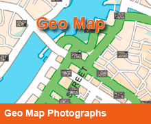
Using GPS technology we capture Geo-referenced oblique photographs where location coordinates, date & time are embedded in the photographs hidden text tag. Information stamped on the photograph itself may also be provided. Such geo information enables the images to be utilized on Google Earth, Arch Info and other GIS systems. We can also link the photographs to localized maps (see viewer).
Our Geo Map Photography service is especially useful in project progress reports as images can be searched for according to date captured and/or location. We provide both aerial & ground photography in this Geo-referenced format.
Call us today to further discuss the benefits of using our geo tagged photography.
Benefits:
- Quickly locate photographs
- Improved communication through online map portals
- Link photographs to localized offline maps
